

Camera tour
Price: Free
Time to visit a place: 120 phút
Open Time: 7:00 AM - Close Time: 6:00 PM
Address: Tan Ky Town, Tan Ky District, Nghe An Province
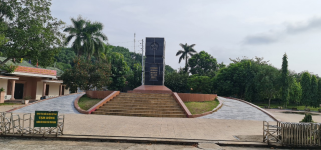
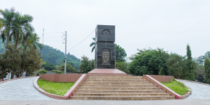
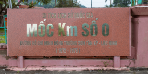
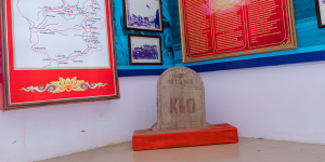
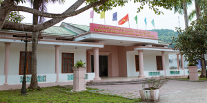
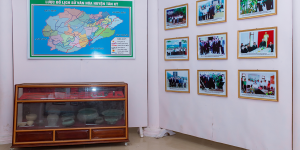
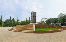
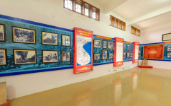
LANDMARK NO. 0 - HO CHI MINH STRATEGIC ROAD (1973)
Landmark No. 0 is the starting point of the legendary Truong Son - Ho Chi Minh road, located near the foot of Dong mountain, the meeting place between road 15A and road 15B, belonging to Lat town, Tan Ky district, Nghe An province. This historical relic is a place to witness the heroic activities of paving the way and transporting of our army and people in the resistance war against the US and save the country.
Truong Son road - Ho Chi Minh road is a strategic military traffic network running from the territory of North of Vietnam to the South of Vietnam through 11 provinces and cities. This transportation system provided troops, food and weapons to support the South Vietnamese Liberation Army and the Vietnam People's Army for 16 years (1959 - 1975). After 1954, when the southern revolution faced many difficulties, President Ho Chi Minh signed a decision for Ministry of National Defense to set up Detachment 559 (founded on May 19, 1959), to study and build communication routes and strategic road named Ho Chi Minh road to support the battlefields of South - Laos - Cambodia. Dozens of engineering units, young volunteers, and civil servants protected by the air defense and air force, and the people's support, participated in the campaign to pave the way. In 16 years, Truong Son army corps has built 4 road networks with a total length of 17,000km, including 5 systems of vertical and 21 horizontal axes along the length of Truong Son range and radiating throughout the provinces from Nghe An to the Southeast of Vietnam, Laos and Cambodia.
On September 09, 1964, Engineers Regiment 98 chose Lat town, Tan Ky district to make the first hoe to build the starting point in Nghe An province. Milestone No. 0, Truong Son road - Ho Chi Minh road running through Tan Ky district was formed on the basis that there was a section using the trails of ethnic minorities, there were places for further repair. Many new sections had to go through forests and cut streams to ensure fast, secret and safe transportation. The process of road construction, protection and transportation taking place at Milestone No. 0 and the whole road through the communes of Tan Ky district was a process of hard work and struggle. In 1965, the first convoy of trucks sailed successfully. Since then, tens of thousands of vehicles had continuously transported people, goods and weapons along National Highway 1 and Ho Chi Minh Road to the southern battlefield.
On November 27, 1972, in order to strengthen the transportation capacity to the South, the Politburo and the Central Military Commission assigned Corps 559 to start construction of a motorized transport route starting from Lat town (Tan district) to prepare for major campaigns to liberate the South and reunify the Fatherland.
During the Vietnam War, the military forces of the United States and Republic of Vietnam frantically ravaged this transport system with very strong infantry and air campaigns, so this was once called the "Line of Fire". In which, Landmark No. 0, Truong Dong, along the road through Ky Son and Nghia Hanh communes, was carpeted continuously by the US Air Force. Many forests were destroyed, the road system was damaged, many heroic soldiers sacrificed but could not shake the resistance of our army and people. This route is "the most important and basic road, creating decisive battles to bring the resistance war against the US and save the country to complete victory". During the resistance war against the US, the whole route organized the transportation of 445 million tons of weapons, food, ammunition, 58 million tons of petroleum, millions of soldiers into the battlefields to fight the US - puppets and henchmen, ensure smooth communication from the North to the South, bring wounded and sick soldiers to the North for treatment, and smoothly transport cadres from the South to the North for work...
Landmark No. 0 relic, Truong Son road - Ho Chi Minh road carried many historical meanings. That was the place to gather troops and start building camps of Engineer Regiment 98, soldiers of Division 316A, 316B and volunteer youths. Here on December 2, 1974, General Van Tien Dung visited and assigned tasks before the division attacked to liberate the Central Highlands...
The relic has a number of locations, the main items include: Landmark No. 0; accomodation and camps of soldiers and youth volunteers to build roads; Nameless Hill - where the Division Command was stationed, where General Van Tien Dung was welcomed in 1974; logistics depot - weapons.
With important historical values, marking a very fierce but very heroic historical period of the Vietnamese people in the resistance war against the US, saving the country, the location Landmark No. 0 - Ho Chi Minh strategic road has been classified as a national historical and cultural relic by Ministry of Culture, Information, Sports and Tourism in Decision No. 84/QD-VH on April 27, 1990. Then, in Decision No. 2383/QD-TTg dated December 9, 2013, the Prime Minister of the Socialist Republic of Vietnam ranked Truong Son Road - Ho Chi Minh Road as a Special National Monument.
Over time, the historical site Landmark No. 0 - Truong Son Road - Ho Chi Minh Road has been restored and embellished many times and is now becoming a red address, an important historical and traditional education site of the locality.
Distance: 2.52 km
Distance: 3.25 km
Distance: 12.94 km
Distance: 17.09 km
Distance: 17.86 km
Distance: 18.08 km
Distance: 18.13 km
Distance: 18.29 km
Distance: 18.32 km
Distance: 120 m
Distance: 170 m
Distance: 320 m
Distance: 320 m
Distance: 560 m
Distance: 580 m
Distance: 770 m
Distance: 1.09 km
Distance: 1.35 km
Distance: 11.33 km
Distance: 16.21 km
Distance: 17 km
Distance: 17.05 km
Distance: 17.86 km
Distance: 17.99 km
Distance: 18.19 km
Distance: 18.19 km
Distance: 18.25 km
Distance: 0 m
Distance: 8.70 km
Distance: 10.69 km
Distance: 10.71 km
Distance: 13.47 km
Distance: 13.47 km
Distance: 14.30 km
Distance: 14.31 km
Distance: 14.40 km
Distance: 14.58 km
Distance: 14.86 km
Distance: 14.98 km
Distance: 18.19 km
Distance: 18.32 km
Distance: 18.32 km
Distance: 1.34 km
Distance: 16.32 km
Distance: 17.80 km
Distance: 18.25 km
Distance: 19.16 km


0
No Comment!